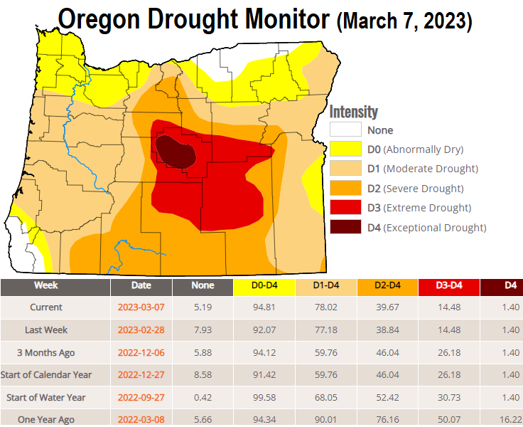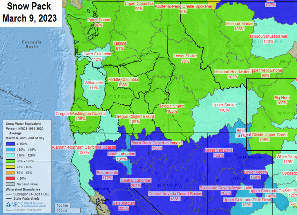
We're behind by over 10"! We've recorded 20.25" of precipitation since the start of the water year on Oct 1, normal to date is 31.24". 78% of Oregon is in a drought. The good news is that snowpack across all of Oregon is over 100% of average (our region's at 111%).


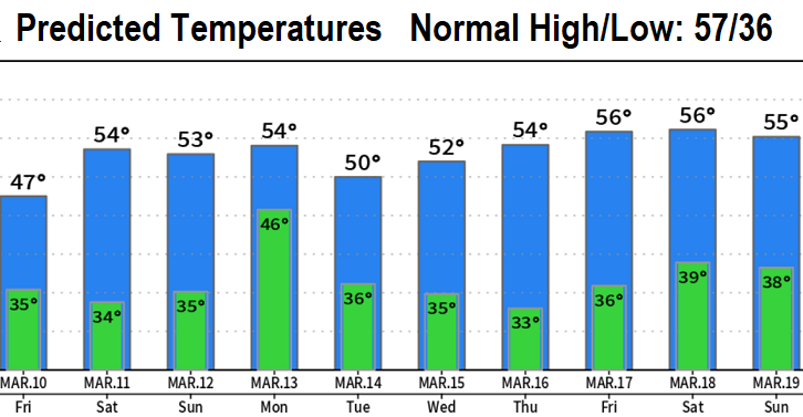
Five to six storm systems will bring 2-4" of rainfall over the next 10-days. It'll get breezy at times, with wind gusts up to 20-30mph. These storms will be warmer than what we've seen over the past couple of months, so no threat of snow here in Cottage Grove (snow levels fluctuate at 1500-4500').

Looking way ahead (preliminary / low accuracy): seeing early signals that April may have near to slightly below normal precipitation with temperatures also near to slightly below normal. Probabilities for May hint at near to above normal temps with near to below normal rain. Odds for June favor above normal temperatures and near normal rainfall. July/August odds favor above normal temperatures (doesn't mean we'll be sweltering hot).
La Nina: "Neutral" conditions now exist in key parts of the Equatorial Pacific, meaning neither a La Nina or El Nino is present. The atmosphere is starting to reflect this. High chances that El Nino will form over the summer and continue through next Fall and Winter. Will talk more about this during summer as we'll have a better idea on predicted strength and what may occur here (different strengths = different outcomes).
