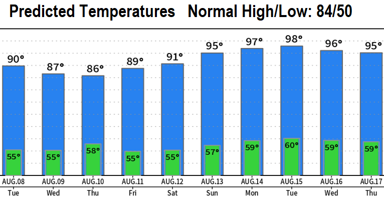
NEXT FEW DAYS: You'd never know it because high temps will still be warm (mid-upper 80's), but a couple of weak low pressure systems will pass through the region over the next few days. The first one passed through this morning and the next one is due to arrive early Wednesday morning. So expect varying amounts of passing clouds at times but no rain.
HEATWAVE TIMELINE: High pressure begins to build back in on Thursday. This means high temperatures will only go up each day, with an extended heatwave expected Friday through the end of next week (Aug 19, as it looks now).
HOW HOT? Highs in the mid 90's to around 100° will be common starting Saturday or Sunday and continuing through most or all of next week! The good news is that data predictions have slightly backed off on how hot it will get (now upper 90's to around 100 vs 100-104 a few days ago).
SMOKE from regional fires may be blown into our area at times as winds shift around. This would cause our air quality to decrease.
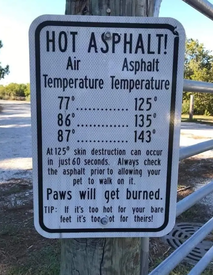
HOT PAVEMENT (over 125°) FOR PAWS during the afternoon and evening. An easy way to tell if the pavement is safe for your dog's paws is to hold your hand on it for 7 seconds. If it's too hot for you, it's too hot for them. Skin destruction on the paws can occur in less than 60 seconds! Morning or late evening walks are best since pavement will be much cooler (before 11am or after 7pm).
Subscribe to receive updates when we post weather and preparedness updates to our blog. You can elect immediate, daily, or weekly emails. We anticipate a fairly low volume - 3 to 5 posts per week.