Heatwave = Very Hot with record or near record temperatures. Promise of much cooler temps Friday through next weekend.
August 13, 2023
HEATWAVE UPDATE (Sunday):
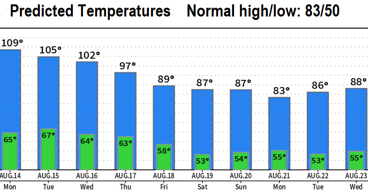
VERY HOT: No matter which way you roll the dice, it's going to be hot with record or near record temperatures Monday and Tuesday.
RECORDS: Regarding records, high temps will likely set a new record for the specific DATE but not an all time record ever. The closest climate station is Eugene so we refer to those numbers when looking at records. Eugene's record high temps for Mon Aug 14, Tue Aug 15, and Wed Aug 16 are all 101° (set in 1899, 1902, and 1899, respectively). So highs in the low 100's this time of year is NOT common. Eugene's ALL TIME HIGH TEMP RECORD FOR THE MONTH OF AUGUST is 108° set in 1981. The highest temperature in recorded history was 111° set in June 2021.
COOLING TREND begins Thursday but it will be most noticeable on Friday. Next weekend's high temps are expected to be closer to normal.
PATTERN CHANGE: It still looks like a pattern change will occur next weekend, but there's still some questions on how much influence low pressure systems will have to cause high temps to be in the upper 70's/low 80's vs low/mid 80's. Tropical Storm Fernanda (soon to be Hurricane Fernanda) is currently well southwest of the tip of Baja California. Although this is very far away from us, it will have some impact on the west coast weather pattern over the next 7-days so we'll be watching if any remnants interact with a low pressure system that's expected to develop offshore of Oregon later next weekend.
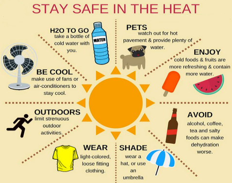
SMOKE & AIR QUALITY: Shifting winds will probably blow varying amounts of smoke into our area and allow for hazy skies with decreased air quality. This causes the heat effects on us to be worse due to poor air quality. Therefore, it's always best to avoid strenuous activities and stay indoors where it's cooler with air conditioning.
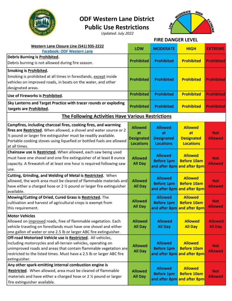
FIRE DANGER RATING IS AT EXTREME - the highest rating.
Subscribe to receive updates when we post weather and preparedness updates to our blog. You can elect immediate, daily, or weekly emails. We anticipate a fairly low volume - 3 to 5 posts per week.