Friday Weather Update: Winds shifted overnight to blowing from an easterly direction. This transported smoke from the Bedrock Fire (northeast of Lowell, west of Oakridge) into our area. The Fire is currently at 8200 acres, is zero percent contained, and poses no threat to our local area. The satellite image shows the smoke initially being blown to the west. THEN notice this afternoon the smoke reversing course and blowing to the east as the wind direction shifts to coming from the west. Over the next 5-7 days, winds will shift at times and may therefore blow varying amounts of smoke into our area.
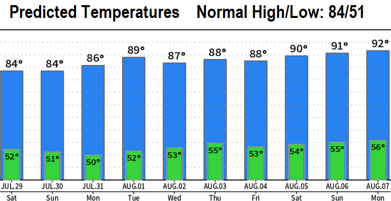
High temperatures Sat/Sun are expected to be in the lower 80's (right around normal). There may be some night and morning marine clouds. If this occurs, it'll burn off by about 10am. It's looking like next week will warm to 85-90 with low 90's then possible the following weekend (Aug 5-6), as high pressure strengthens. At this time, no rain in sight. Fire danger rating continues to be high.

Friday's satellite image from about 8:00am to 4:10pm. Notice the smoke initially being blown from east to west then begins to shift, as winds change direction, to be blown from west to east.