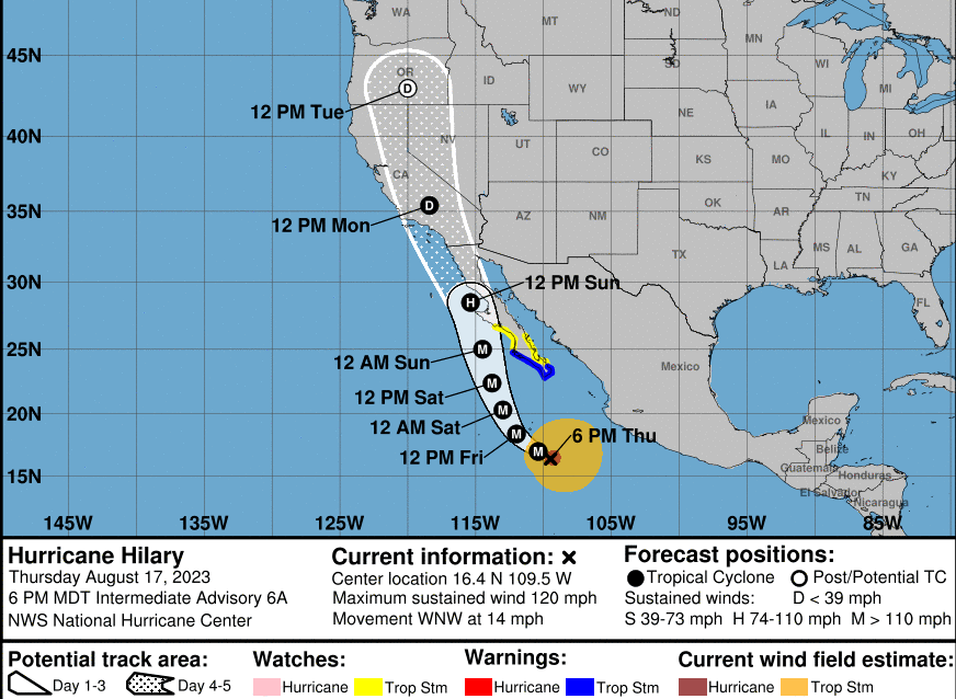
Less humidity/clouds tomorrow (Friday). Hurricane Hilary unlikely to still be a hurricane when it reaches the Cali/MX border. Hurricane season in the Eastern Pacific begins on May 15 and ends on November 30. Impacts here in Oregon could be clouds, humidity, and maybe some showers on Monday and Tuesday - if the currently favored projected path is correct of where most of the leftover moisture treks (right now looks to remain east of the Cascades). We certainly won't see any hurricane or tropical storm winds from this system. But if any thunderstorms form around here on Mon/Tue, those, as always, could produce gusty winds. Again, lots of uncertainties right now with the track of Hilary - some model tracks have the remnants going into eastern Oregon but most project the remnants going through central Oregon.
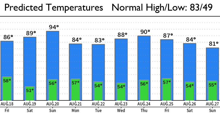
Anyways...For us, we should get a break tomorrow (Friday) from the monsoon moisture and ridiculous humidity that's been affecting us over the last several days. But then Saturday, humidity may start increasing again along with some clouds and a brief warming trend (that will peak on Sunday before a little cooling on Monday). With leftovers from Hilary possibly affecting Oregon, as I mentioned above, humidity and clouds are expected to increase on Monday and Tuesday (but it won't be as hot as it has been). Too soon to say whether we'll get any rainfall. That's hot the cookie crumbles right now.

