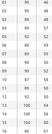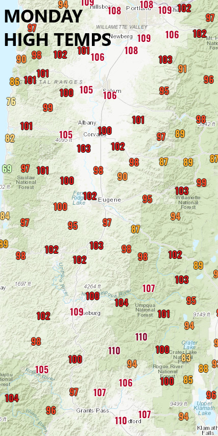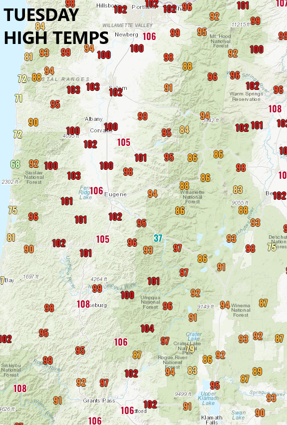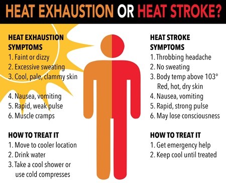
How HOT was it? Scroll down and check out the maps/charts for high temperatures since Sunday! On Monday's map, notice the 109° in Roseburg, 110° in Medford & Grants Pass, and 108° in Portland. Because of smoke overhead here, we only hit 100, otherwise we'd been around 105/106. Tuesday (yesterday), we hit 104 and today is shaping up to be 100-104. The chart with just two columns of numbers are the high and low temps HERE since Aug 1.
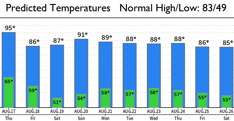
Cool down starts TOMORROW (Thurs) with highs 90-95. It then looks like the cool down bottoms out on Friday through the weekend with highs somewhere between 83-88. Weekend and early next week temps may be lower and I'll put up a post about that tomorrow or Friday about this. Night/morning marine clouds may start seeping in possibly tonight but more likely Thursday night into Friday morning. But hey, at least it's better than 100, right? Scroll down to see predicted temperatures over the next 10-days.
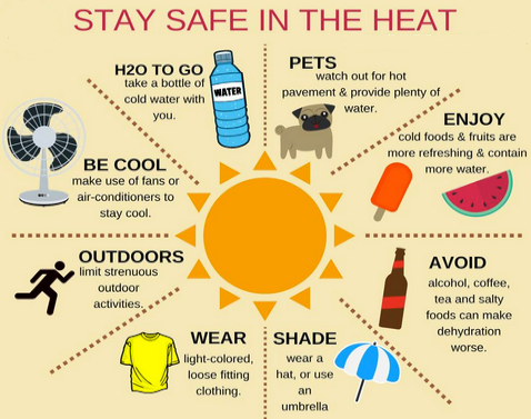
Smoke may also become less intrusive into our area starting tomorrow or Friday as those winds that are mostly blowing from an easterly direction switch to a more northwesterly direction. Fire danger rating is still at EXTREME, which is the highest level.